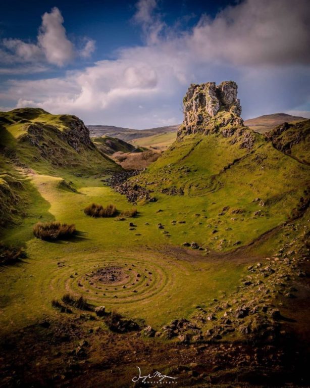
Photo Credit:
Darryl Morgan | IG: @darrylmorganphoto | Original Post: June 19, 2020
At a Glance:
| Location: | Just west of the town of Uig Isle of Skye, Scotland, UK |
| Trail or Landmark Name / Map: | Fairy Glen |
| Parking Coordinates: | 57.5839028,-6.3268083 (street shoulder) |
| Photo Coordinates: | 57.5825844,-6.3246751 |
| Distance: | .25 miles round trip, Out-and-Back |
| Time to Complete: | 30 minutes |
| Difficulty: | Easy |
| Elevation Gain: | Unknown |
| Quick Facts: | ✔ Free ✔ Kid Friendly ✔ Dog Friendly (Leashed) ✖ Restrooms Available ✖ Wheelchair Accessible ✖ Bike Friendly |
Description:
The photographer posted this photo on June 19, 2020.
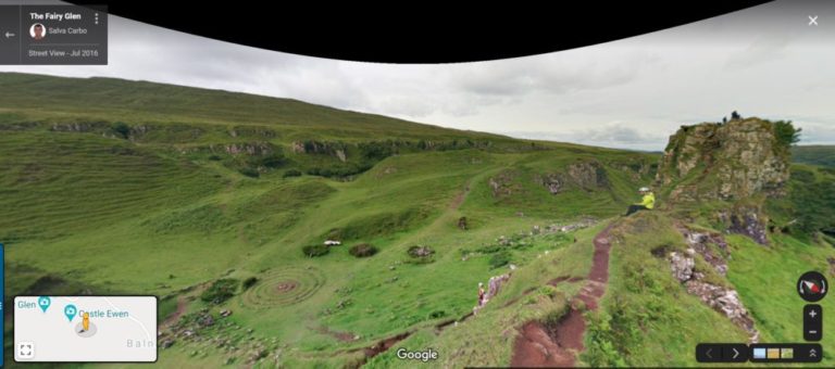
Google Map to “The Fairy Glen, Highland Skye, UK.” At the parking coordinates above, you will find a small pullout off the side of the narrow road, large enough to fit two cars. There are several other small spots to park off the side of the road near this one, but no lot. Because parking is so limited, some reviewers suggest parking in the town of Uig just to the west—a 15- to 30-minute walk to Fairy Glen.
Once you are parked, walk up the hill for 5-10 minutes towards the large rock in the photo. You’ll be able to see it from the road. The photo coordinates above will get you pretty close to the photo location. There are small pathways in the area worn into the grass from years of pedestrian traffic, but you will have free reign to wander all around the area as you wish.
Helpful Links:
Additional Information
Atlas Obscura Page
Reviews on Google
Additional Images: