Photo Credit:
Philip Klinger | Deviant Art: Aphantopus | Original Post: March 18th, 2013
At a Glance:
| Location: | Eldhraun, Iceland is halfway between Vik and Hof near the small village of Kirkjubæjarklaustur |
| Trail or Landmark Name / Map: | Eldhraun Lava Field |
| Parking Coordinates: | 63742694,-18172083 (lot), right off of Route 1 or “Ring Road,” can stop anywhere |
| Photo Coordinates: | 63.7426144,-18.1720539 |
| Distance: | n/a, just off side of road |
| Time to Complete: | 15 minutes |
| Difficulty: | Easy |
| Elevation Gain: | n/a |
| Quick Facts: | ✔ Free ✔ Dog Friendly ✔ Bike Friendly ✔ Kid Friendly ✔ Wheelchair Accessible (if you stay on main road) ✖ Restrooms Available |
Description:
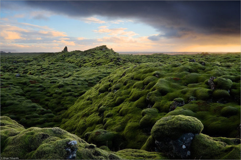
The photographer posted this photo on March 18th, 2013 during the sunrise near KIRKJUBÆJARKLAUSTUR (Klaustur).
Eldhraun lava field is 565 square km (218 sq miles) large and can be seen right off the main C-shaped road, Route 1, or Ring Road. This road takes you through the upper part of the C, and is great for either a beautiful drive or a place to hop out and explore for awhile.
If you’d like to stop, there is a parking area towards the end of the drive with historic signage to read, but there are other parking spots along the road that have some small trails attached if you would like to carefully walk close to the fields.
This field was created by one of the most violent volcanic eruptions in history, the Lakagígar eruption in the 1700s. Over time, moss grew over the lava rocks. Because of this, walking on the lava field is not allowed as it is very fragile and dangerous. We’d recommend you wear hiking boots for this area. Even though moss is soft, it is very hard on your feet.
Helpful Links:
Kirkjubæjarklaustur Tourist Information Office
Iceland Travel – About Eldhraun
Ring Road Information and Reviews
Additional Images:
