Photo Credit:
Zach Ellis | IG: @zrellis25 | Original Post: June 1, 2020

At a Glance:
| Location: | Schooley’s Mountain Long Valley, NJ 07853 |
| Trail or Landmark Name / Map: | Schooley’s Mountain |
| Parking Coordinates: | 40.7947925,-74.7706666 (lot) |
| Photo Coordinates: | Near 40.796872, -74.783691 |
| Distance: | Full Trail: 3.1 miles, Loop Photo Location: 1 mile round trip, Out-and-Back |
| Time to Complete: | Full Trail: 1-2 hours Photo Location: 1 hour |
| Difficulty: | Moderate |
| Elevation Gain: | 672 ft |
| Quick Facts: | ✔ Entrance Fee: Free ✔ Restrooms Available ✔ Dog Friendly ✔ Kid Friendly ✖ Bike Friendly ✖ Wheelchair Accessible |
Description:
The photographer posted this photo on June 1, 2020.
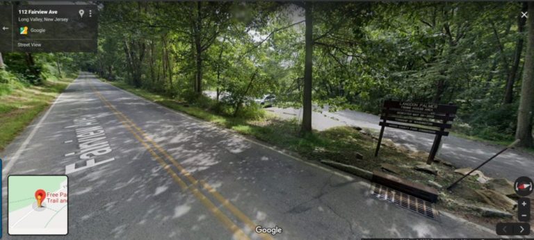
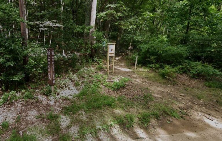
Park in the lot off Fairview Avenue on the east side of the trail, then cross to the west side of Fairview and find the trailhead where you sill see some signage marked “Patriot’s Path.” Begin here.
Many people say that it’s easiest taking the trail clockwise. Follow the blue trail clockwise for about .4 miles until you see it split off to the right. Take the right fork and follow the blue trail about another .1 mile. Break off to the black trail a this point until you reach the Electric Brook in .3 or so miles. We believe the falls will be located around this point.
Note that the path is rocky, slippery, and requires some scrambling around obstacles.
Helpful Links:
Trail Map
Interactive Trail Map
Additional Trail Information
Trail Reviews on AllTrails.com
Additional Images: