Photo Credit:
Zac Warwick | IG: @zacventure | Original Post: June 10, 2020

At a Glance:
| Location: | Vermilion Cliffs National Monument White Pocket, Arizona, USA, 86036 |
| Trail or Landmark Name / Map: | White Pocket |
| Parking Coordinates: | 36.955150, -111.893689 (lot) |
| Photo Coordinates: | 36.955154, -111.897594 |
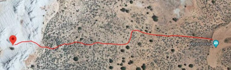
| Distance: | Full Trail: 1.5 miles, Loop Photo Location: 1 mile round trip, Out-and-Back |
| Time to Complete: | 1-2 hours |
| Difficulty: | Easy |
| Elevation Gain: | 160 ft |
| Quick Facts: | ✔ Free ✔ Kid Friendly ✔ Dog Friendly ✖ Bike Friendly (not prohibited, but deep sand would make it difficult) ✖ Restrooms Available ✖ Wheelchair Accessible |
Description:
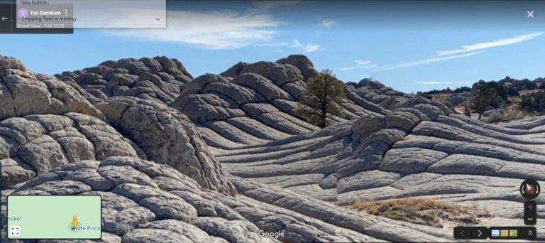
The photographer posted this photo on June 10, 2020. “The Tree” is best photographed at sunrise and sunset.
White Pocket, an area of the Vermilion Cliffs National Monument in Arizona, is often called the “brain rock” by photographers, due to its interesting “wrinkled” textures.
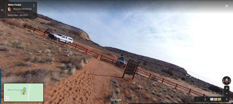
The drive there will be the most difficult part of your visit. A high-clearance 4×4 vehicle is required, as there are many deep pockets of sand. There are dozens of reviews online from people who never made it to White Pocket because their cars got stuck in the sand, so drive with caution. One positive about the rough drive is that White Pocket is rarely crowded.
Google Map to “White Pocket, Arizona 86036”. This should take you straight to the parking lot, but because many users have reported that Apple Maps and other apps have been inaccurate, you may want to take a look at more detailed driving directions before you leave.
From the parking lot, walk west along the trail. Once you hit White Pocket, the well-defined trail ends and you are free to explore on your own around the cliffs. The photo location above is about .5 miles straight west from the parking lot. There are very few trees on top of White Pocket, so you should be able to spot this Ponderosa Pine tree fairly easily if you navigate to the photo coordinates.
There is a loop trail you can follow around White Pocket on AllTrails, but you do not need to traverse the whole thing to reach the photo location.
Helpful Links:
Trail Map
Trail Information
Additional Information
White Pocket Photo Map (photos of all points of interest in the area)
Additional Images: