Photo Credit:
Unknown
At a Glance:
| Location: | Banff National Park Alberta, Canada |
| Trail or Landmark Name / Map: | Lake Louise |
| Parking Coordinates: | 51.4136287,-116.2307957 (lot) |
| Photo Coordinates: | 51.4080462,-116.2395133 |
| Distance: | 2.9 miles / 4.7 km round trip, Out-and-Back |
| Time to Complete: | 1 hour |
| Difficulty: | Easy |
| Elevation Gain: | 331 ft / 101 m |
| Quick Facts: | ✔ Entrance Fee: $10 CAD/ person 18+ ✔ Dog Friendly (leashed) ✔ Kid Friendly ✔ Restrooms Available ✔ Wheelchair Accessible ✖ Bike Friendly (you can bike to the lake, but not around it) |
Description:
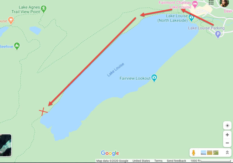
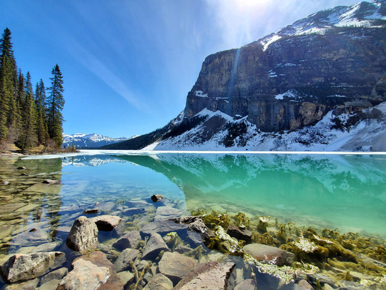
The photographer posted this photo on June 1, 2020 from the southwest side of the lake.
Google map to “Lake Louise Parking, 111 Lake Louise Dr, Lake Louise, AB T0L 1E0, Canada.” Warning: Lake Louise is arguably the most famous lake in Canada and an EXTREMELY popular tourist attraction, so parking is almost always at capacity in the lot as well as down all of the side streets. You will need to arrive as early as possible or wait until later in the evening unless you want to fight for a spot as people leave throughout the day.
From the parking lot, it takes about 30 minutes to walk to this photo location, following the lake around counter-clockwise. This view is located on the north side of the southwest end of the lake. See map below.
Note that there is a $10 CAD entrance fee per 18+ person to enter Banff National Park.
Helpful Links:
Trail Map
Additional Travel Info
Trail Reviews on AllTrails.com
Additional Images: