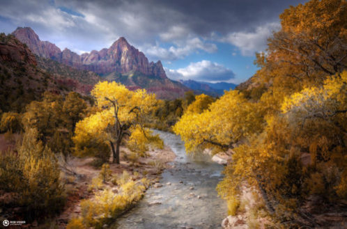
Photo Credit:
Rob Visser | IG: @rob_visser_photography | Original Post: November 22, 2019
At a Glance:
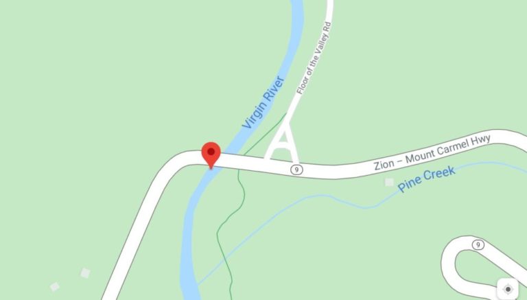
| Location: | Zion National Park Near intersection of Zion-Mount Carmel Highway (Hwy 9) and Floor of the Valley Road Springdale, Utah, USA |
| Trail or Landmark Name / Map: | Canyon Junction Bridge over the Virgin River |
| Parking Coordinates: | 37.2175627,-112.975593 (street shoulder) |
| Photo Coordinates: | 37.2174722,-112.9762347 |
| Distance: | n/a, just off side of road |
| Time to Complete: | 15 minutes |
| Difficulty: | Easy |
| Elevation Gain: | n/a |
| Quick Facts: | ✔ Entrance Fee: $35 / car ✔ Dog Friendly ✔ Bike Friendly ✔ Kid Friendly ✔ Wheelchair Accessible ✖ Restrooms Available |
Description:
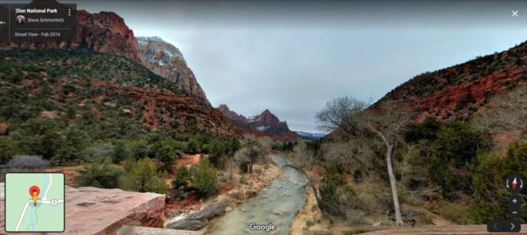
The photographer posted this photo on November 22, 2019, when the fall colors were still in bloom, from the south side of the Canyon Junction Bridge over Virgin River (facing south).
This view in Zion National Park can be found by parking off the road shoulder near the intersection of Zion-Mount Carmel Highway (Hwy 9) and Floor of the Valley Road. Walk west over to the Canyon Junction Bridge and view the breathtaking scene from the bridge itself, or walk north on Floor of the Valley Road towards the bus stop, where you will find an access trail on your left that goes down under the bridge if you would like to walk along the river.
Keep in mind that this view is located inside Zion National Park, so there is a $35 per car entrance fee (which is good for 7 days).
Additional Images: