Photo Credit:
Chris Cooley | IG: @chris.cooley | Original Post: June 9, 2019
At a Glance:
| Location: | Kōkeʻe State Park Kauai Island, Hawai’i |
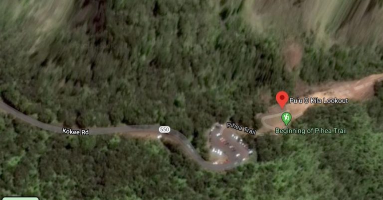
| Trail or Landmark Name / Map: | Pu’u O Kila Lookout |
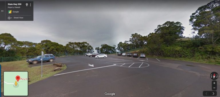
| Parking Coordinates: | 22.1472687,-159.6313824 (lot) |
| Photo Coordinates: | 22.1478694,-159.6309384 |
| Distance: | .1 mile round trip, Out-and-Back |
| Time to Complete: | 15 minutes |
| Difficulty: | Easy |
| Elevation Gain: | n/a |
| Quick Facts: | ✔ Entrance Fee: $5 / car (free to HI residents with ID) ✔ Kid Friendly ✔ Dog Friendly (leashed) ✔ Bike Friendly ✔ Wheelchair Accessible ✔ Restrooms Available (not at Pu’u O Kila, but at the Kalalau Lookout that you will pass about a mile before you reach the Pu’u O Kila Lookout) |
Description:
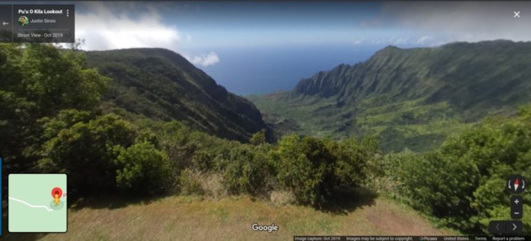
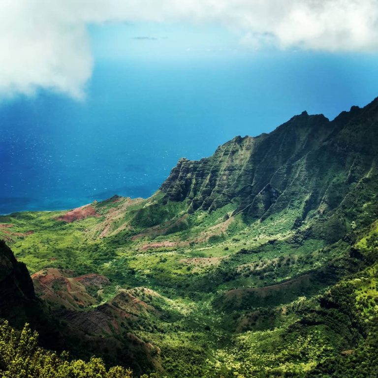
The photographer posted this photo on June 9, 2019.
Pu’u O Kila Lookout has an amazing payoff for just a short walk up a ramp from your car. The valley is often cloudy and foggy though, so you may need to try and time your visit just right. Morning (between 8:00 AM and 11:00 AM) is usually the best time to catch this jaw-dropping view in full sunlight.
Navigate to “Pu’u O Kila Lookout” on Google Maps. It is located at the very end of Highway 550 in Kōkeʻe State Park, on the Kauia Island of Hawai’i. Take Highway 50 west from Hanapepe toward Waimea. Turn right on Waimea Canyon Road just after Mile Marker #23. Pu’u O Kila Lookout is located at the end of the road at Mile Marker #19.
Helpful Links:
Reviews on TripAdvisor.com
Additional Information
Additional Images: