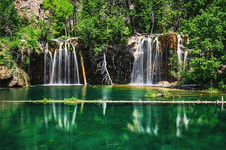
Photo Credit:
Tomas Hoste | IG: @tomashoste | Original Post: September 22, 2019
At a Glance:
| Location: | Hanging Lake Park Glenwood Springs, CO, 81601, USA |
| Trail or Landmark Name / Map: | Hanging Lake |
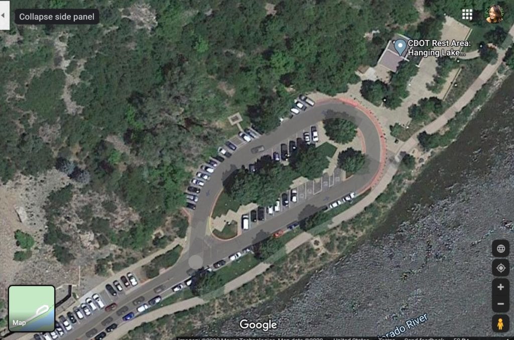
| Parking Coordinates: | 39.589432, -107.190284 |
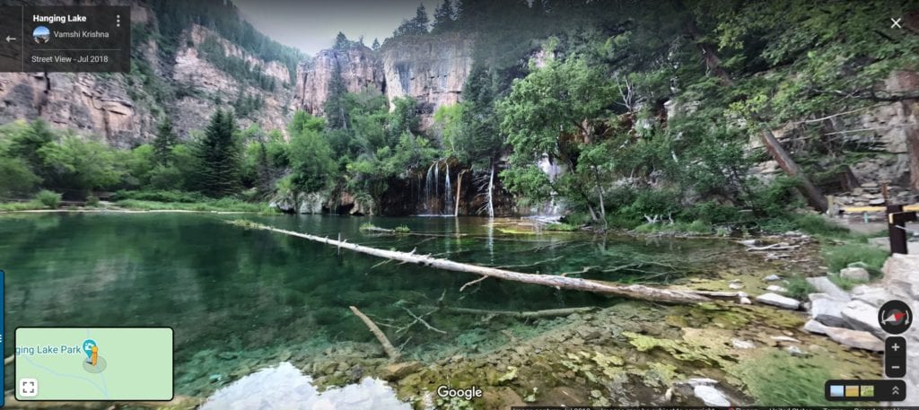
| Photo Coordinates: | 39.6013709,-107.1939658 |
| Distance: | 2.4 miles round trip, Out-and-Back |
| Time to Complete: | 2-3 hours |
| Difficulty: | Moderate |
| Elevation Gain: | 1,000 ft |
| Quick Facts: | ✔ Entrance Fee: $12 / person ✔ Restrooms Available ✔ Kid Friendly ✖ Dog Friendly ✖ Bike Friendly ✖ Wheelchair Accessible |
Description:
The photographer posted this photo on September 22, 2019.
A permit / reservation is required to hike the Hanging Lake Trail and can be obtained from the visitglenwood.com website. The permits cost $12 / person during peak season, and $10 / person during off season.
During off season (November 1 – April 30), Google Map to “Hanging Lake, Glenwood Springs, CO” (I-70 Exit 125) and park in the rest area parking lot (trailhead).
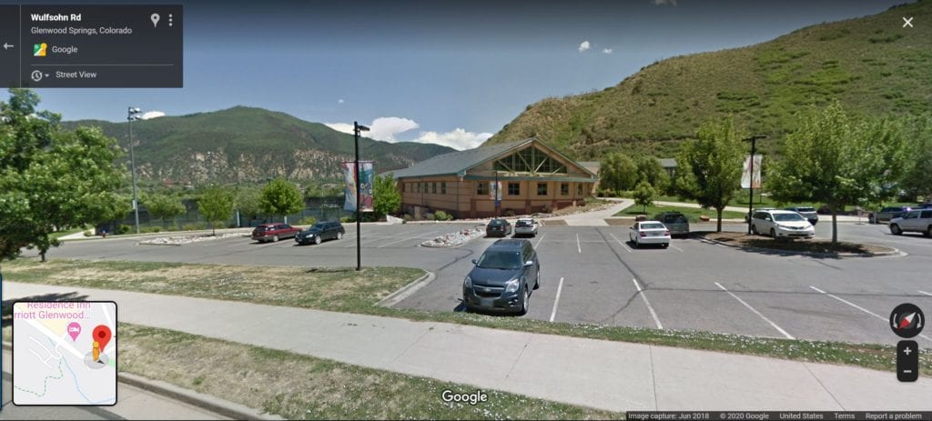
During peak season (May 1 – October 31), you will not be able to park at the trailhead and will be required to shuttle from the Hanging Lake Welcome Center. Google Map to the welcome center at 110 Wulfsohn Road, Glenwood Springs and catch the shuttle there.
You will be asked to present your permit when you arrive at the Hanging Lake rest area. The trail is short but steep with a rocky portion near the end, and can be difficult for non-hikers. However the views are a great payoff. There is a boardwalk at the waterfall that offers many great photo opportunities.
Helpful Links:
Trail Map
Permits and Visitor Information
Additional Images: