Photo Credit:
Ryan B. | IG: @ryb2 | Original Post: May 31, 2020

At a Glance:
| Location: | Trailhead starts in Kanab, UT, while The Wave itself is in AZ Coyote Buttes North, AZ |
| Trail or Landmark Name / Map: | The Wave (hike starts at the Wire Pass Trailhead) |
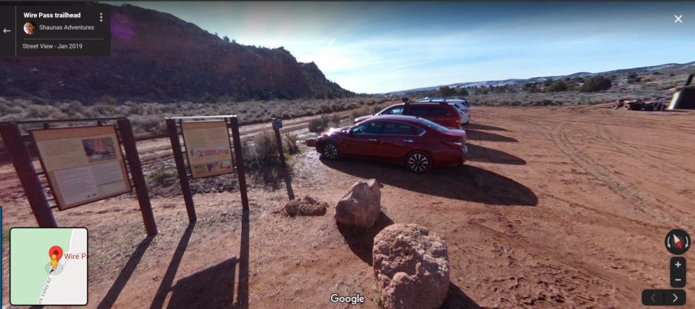
| Parking Coordinates: | 37.01912,-112.0250108 (lot) |
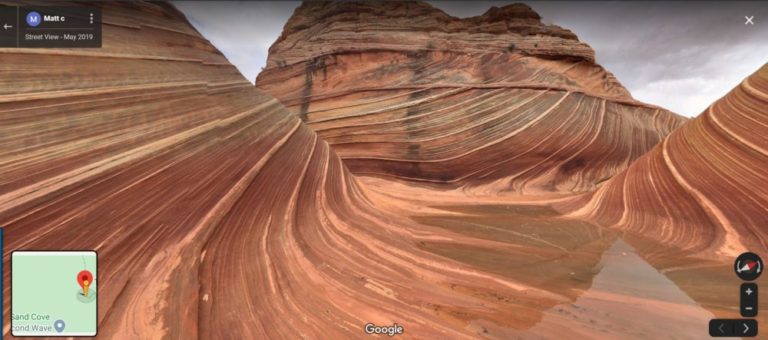
| Photo Coordinates: | 36.9959406,-112.00619 |
| Distance: | 6.4 miles round trip, Out-and-Back |
| Time to Complete: | 2-4 hours |
| Difficulty: | Moderate |
| Elevation Gain: | 1,174 feet |
| Quick Facts: | ✔ Entrance Fee ($9 lottery fee / party + $7 / person) ✔ Restrooms Available (at trailhead) ✔ Dog Friendly ✖ Bike Friendly ✖ Kid Friendly ✖ Wheelchair Accessible |
Description:
The photographer posted this photo on May 31, 2020.
The only way to access The Wave is by winning a permit in a lottery. Only 20 parties are given a permit per day. 10 parties are selected via the online lottery, while the other 10 are selected in a walk-in lottery each morning that the Kanab Visitor is open.
Online Lottery: On the first day of each month at 9:00 AM Mountain Standard Time, the online lottery on recreation.gov opens for the entire month for travel 4 months ahead. For example, if you enter the lottery between June 1 and June 30, you will be eligible for travel in the month of October. You can choose up to 3 trip dates per application to increase your chances of winning one, and there is an application fee of $9.
Walk-In Lottery: The day before you wish to hike, you can visit the Kanab Visitor Center at 8:30 AM to enter the lottery. 10 group numbers will called.
Maximum group size is 6, and permits are non-refundable. If you win a permit, you will be required to pay an additional recreation fee of $7 per person or dog.
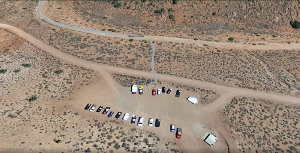
The trail to The Wave begins at Wire Pass Trailhead. Take Highway 89 to House Rock Road (the turnoff is between Miles 25 and 26). A 4WD, high-clearance vehicle is recommended for this road, but most passenger cars can make it if you drive very slowly and carefully. However, if the road is muddy and wet, it is very dangerous even for 4WD vehicles. Take the road for 8.4 miles to the Wire Pass parking lot on the right. There is a restroom here. Cross to the east side of House Rock Road to begin your hike.
The Coyote Buttes North Permit Area does not contain any developed trails or facilities. Permit-holders are given a route description, which includes a route map, photo guide and GPS coordinates along the suggested route to the Wave. There is an extremely helpful and detailed description of the full trail, along with a great aerial video of the entire trail at thewave.info.
The trail terrain is sandy and rocky, and does not provide any shade. Most people say that it’s fairly easy, just a little annoying on the especially sandy parts. Be prepared with plenty of water and sun protection.
Helpful Links:
Permit Lottery Information (permit required to visit)
Trail Map
Trail Description
Trail Video
Trail Reviews on AllTrails.com
Wikipedia Page
Additional Images: