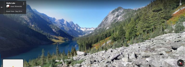
Photo Credit:
Name Unknown | IG: @BC_Wanderer | Original Post: May 31, 2020

At a Glance:
| Location: | Fraser Valley C British Columbia, CA |
| Trail or Landmark Name / Map: | Statlu Lake Trail |
| Parking Coordinates: | 49.5047144,-122.0071677 (street) |
| Photo Coordinates: | 49.5178064,-122.0600718 |
| Distance: | 5.6 miles / 9 km round trip, Out-and-Back |
| Time to Complete: | 4-6 hours |
| Difficulty: | Moderate |
| Elevation Gain: | 1,223 ft / 373 m |
| Quick Facts: | ✔ Free ✔ Dog Friendly ✖ Kid Friendly ✖ Bike Friendly ✖ Restrooms Available ✖ Wheelchair Accessible |
Description:
The photographer posted this photo on May 31, 2020 from the north central side of the lake.
To Parking: A 4×4 vehicle is recommended, but a regular car can make it carefully. From the split of Highway 7 and 11 in Mission, BC, drive east on Highway 7 for 32 km to Morris Valley Road and turn left. Then drive for 16 km to Harrison West Forest Service Road. Then drive for 29.2 km to Chehalis-Mystery Forest Service Road and turn left. Then drive for 8.3 km until the T-junction, where you can park and take the road on the right to the trail.
The trailhead is not well marked. One reviewer said that it was “currently marked with an old plastic gas canister and a worn out sign on a tree behind it.” For the most part, the trail is well marked, but you may want to bring a GPS with an offline setting in case you veer off the trail, as there is no cell coverage.
The terrain can be tough to navigate – expect to scramble through thick bush, fallen trees and unstable rocks. The view at the end is rewarding, and you may continue an additional 1.5 km if you’d like to see the waterfall as well.
Helpful Links:
Trail Map
Additional Trail Info
Trail Reviews on AllTrails.com
Additional Images:

